


South And East England Map
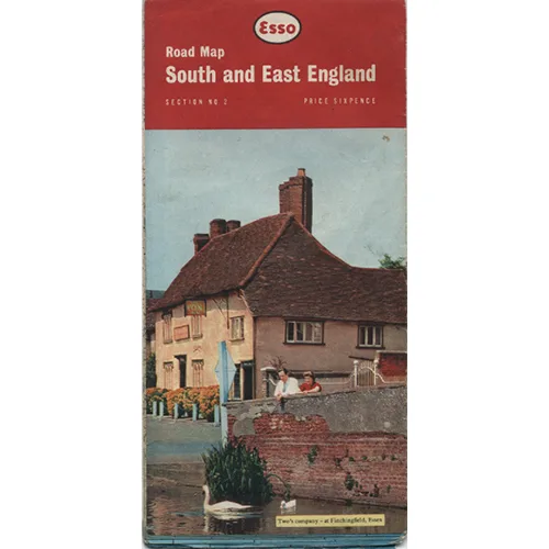
Publisher: Esso
Format: Paperback
ISBN: none
In a world where GPS navigators hover like intrusive digital spirits and Google Maps updates its routes faster than you can say “Where on earth am I?”, the South And East England Map by Esso emerges from the mists of time like a time-traveling cab driver from 1964, eager to take you on a nostalgic jaunt through the long-lost era of petrol stations and paper maps. Dust off your flat cap, adjust your monocle, and prepare to be whisked away on a whimsical journey through the craggy lanes and winding byways of South and East England, a place where the signs were as charmingly ambiguous as the locals at the pub after a couple of pints.
With the Esso logo proudly emblazoned upon its cover, this map is not just a mere collection of roads and towns; it’s a love letter to the age when drivers relied on ink and imagination instead of satellite signals and smartphone apps. The 1964 edition doesn’t just show you where to go; it offers a glimpse into a time when cars were less about speed and more about the joy of the open road—complete with the occasional breakdown, of course. Maps were spread out across the passenger seat, while the driver squinted at the creases, hoping to decipher the riddle of the countryside.
As you trace your finger along the winding routes, you’ll uncover nuggets of forgotten trivia and peculiarities that only a map from this era could provide. Perhaps you’ll discover that the A12 is not just a road, but a legendary pilgrimage route for those seeking the elusive Fish and Chips of Bury St Edmunds. Or maybe the tiny dotted lines leading to nowhere will inspire you to embark on your very own “Journey to the Center of the British Countryside”—where every misstep leads to the delightful embarrassment of asking a sheep for directions.
Furthermore, the map doubles as a time capsule, preserving not just geography but the delightful quirks of a society that had yet to discover the joys of electronic navigation. It’s a veritable cornucopia of quaint village names, most of which sound suspiciously like they were conjured up during a game of Scrabble after three too many gin and tonics. You might find yourself chuckling at these names, pondering how they came to be, or perhaps just how long it’s been since anyone in the village could accurately pronounce them.
Why not indulge in the nostalgia of simpler times? Whether you’re planning a daring road trip through the South Downs or simply want to impress your friends with your knowledge of obscure British geography, this map is a charming companion. It’s also a fabulous conversation starter at dinner parties—who could resist discussing the wonders of 1960s motoring over a plate of overcooked roast lamb?
Condition: Used, and hey, it’s got character! This particular map has seen its fair share of road trips; the corners are dog-eared, and the creases tell tales of the adventures it has endured. Who knows how many chips have been consumed while consulting this cartographic marvel? There might even be a coffee ring or two; each one a testament to a spontaneous roadside stop and a candid chat with a local about the best way to avoid getting lost.
So, embark on your own adventures armed with this delightful relic of a bygone era. Go on, be the Indiana Jones of the English countryside, armed only with a paper map, a questionable sense of direction, and a spirit that revels in the absurdity of misadventure. And remember, each page turn is a step away from the digital grind and back into a world where the road less traveled could lead to the best fish and chips you will ever have. Available now from Crappy Old Books, where we celebrate the glorious imperfections of literature, one slightly tattered page at a time.
Keep browsing: See more Maps books Other books by Esso
